At SL VOYO, Sri Lanka’s first travel platform, we help travellers discover Sri Lanka through experiences that go beyond basic sightseeing. Whether you are joining our tours or planning your own journey, this is your friendly guide to exploring the island in a simple and meaningful way.
Major Rivers in Sri Lanka
Sri Lanka has over 100 rivers, most of which begin in the central highlands. These rivers flow in different directions and play an important role in agriculture, water supply, and daily life.
Some rivers flow all year round, while others depend on rainfall. The longest and most important rivers are listed below.
Major Rivers in Sri Lanka (Table)
River Name
Destination
Length (km)
Basin Area (km²)
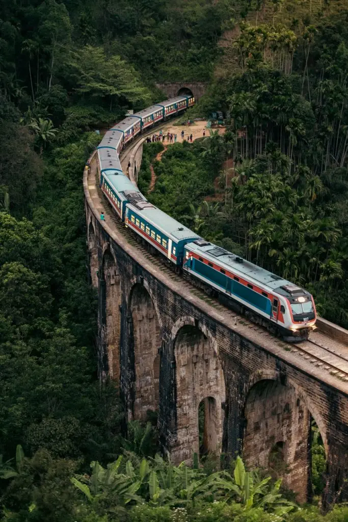
Mahaweli Ganga
Trincomalee
335
10,448
Aravi Aru
Mannar
164
3,284
Kala Oya
Puttalam
148
2,805
Kelani Ganga
Colombo
145
2,292
Yan Oya
Pulmoddai
142
1,538
Deduru Oya
Chilaw
142
2,647
Walawe Ganga
Hambantota
138
2,571
Maduru Oya
Batticaloa
135
1,559
Maha Oya
Negombo
134
1,528
Kalu Ganga
Kalutara
129
2,720
Kirindi Oya
Hambantota
117
1,178
Kumbukkan Oya
Pottuvil
116
1,233
Menik Ganga
Hambantota
114
1,287
Gin Ganga
Galle
113
932
Mi Oya
Puttalam
109
1,533
Gal Oya
Batticaloa
108
1,873
Mahaweli Ganga
Mahaweli Ganga is the longest and most important river in Sri Lanka. It begins in the central highlands and flows across the island to Trincomalee.
This river supports the largest irrigation system in the country. The Mahaweli Development Project supplies water to thousands of farms. It also generates hydroelectric power through dams like Victoria and Rantembe.
An interesting fact is that this river changed the economy of Sri Lanka by expanding agriculture in dry zones.
Aravi Aru
Aravi Aru flows through the northern dry zone and ends near Mannar. It plays an important role in agriculture in the northern region.
This river depends heavily on seasonal rainfall and is less active during dry periods. It supports local farming communities.
A unique fact is that Aravi Aru is one of the key rivers helping develop agriculture in northern Sri Lanka.
Kala Oya
Kala Oya flows into the Puttalam lagoon and is historically important. It was part of ancient irrigation systems used by early Sri Lankan kingdoms.
The river supports tanks and reservoirs built centuries ago. It still helps farming in the dry zone today.
A key fact is that Kala Oya connects modern Sri Lanka with its ancient hydraulic civilization.
Kelani Ganga
Kelani Ganga is one of the most important rivers for Colombo. It provides drinking water and supports industries in the capital.
The river begins in the central hills and flows through urban and rural areas. It is also used for hydropower generation.
An interesting fact is that Kelani Ganga is linked to the ancient Kelaniya Temple and Sri Lankan legends.
Yan Oya
Yan Oya flows to the north-eastern coast near Pulmoddai. It is important for irrigation and local agriculture.
The Yan Oya Reservoir project has improved water supply in the dry zone. It supports both farming and rural life.
A unique fact is that this river plays a key role in developing agriculture in underdeveloped regions.
Deduru Oya
Deduru Oya flows into the sea near Chilaw. It is one of the major rivers in the north-western region.
The Deduru Oya Reservoir helps control floods and store water for irrigation. It benefits farmers throughout the year.
A key fact is that this river is essential for rice cultivation in the north-west.
Walawe Ganga
Maduru Oya flows to the eastern coast and supports agriculture and wildlife. It is linked to Maduru Oya National Park.
The river provides water for farming and helps maintain biodiversity in the region.
A special fact is that this river supports both human life and protected wildlife areas.
Maduru Oya
Maduru Oya flows to the eastern coast and supports agriculture and wildlife. It is linked to Maduru Oya National Park.
The river provides water for farming and helps maintain biodiversity in the region.
A special fact is that this river supports both human life and protected wildlife areas.
Maha Oya
Maha Oya flows into the sea near Negombo. It is important for sand mining and local industries.
The river is also used for irrigation and small-scale fishing. It supports communities along its path.
An interesting fact is that Maha Oya plays a role in Sri Lanka’s construction industry due to sand resources.
Kalu Ganga
Kalu Ganga flows through the wet zone and reaches the sea at Kalutara. It carries a large volume of water, especially during heavy rains.
The river supports farming and transportation. However, it is also known for flooding during monsoon seasons.
A key fact is that Kalu Ganga is one of the most powerful rivers in terms of water flow.
Kirindi Oya
Kirindi Oya flows through the dry zone and ends near Hambantota. It is important for irrigation in southern Sri Lanka.
The river supports farming and water supply in dry regions. It is also connected to ancient irrigation systems.
An interesting fact is that Kirindi Oya has been used for farming for centuries.
Kumbukkan Oya
Kumbukkan Oya flows to the eastern coast near Pottuvil. It is known for its natural beauty and forest surroundings.
The river supports wildlife and agriculture in the eastern region. It flows through less crowded areas.
A unique fact is that this river remains relatively untouched and natural.
Menik Ganga
Menik Ganga is a sacred river that flows near Kataragama. It is important for religious activities and pilgrimages.
Pilgrims use the river for rituals and cleansing during festivals. It also flows through Yala National Park.
An interesting fact is that this river connects nature, wildlife, and religion in one place.
Gin Ganga
Gin Ganga flows through Galle and is surrounded by greenery. It is known for its scenic beauty and calm flow.
The river supports fishing and small transport activities. It is also important for local agriculture.
A key fact is that Gin Ganga adds to the charm of southern Sri Lanka’s landscape.
Mi Oya
Mi Oya flows into the Puttalam area and supports dry zone agriculture. It is important for irrigation.
The river depends on seasonal rainfall and helps sustain farming communities.
An interesting fact is that Mi Oya plays a quiet but important role in rural livelihoods.
Gal Oya
Gal Oya flows to the eastern coast and is one of the most important rivers in that region. It supports agriculture and wildlife.
The Senanayake Samudraya reservoir is built on this river, one of the largest in Sri Lanka. It supplies water to large farming areas.
A unique fact is that Gal Oya National Park offers boat safaris where you can see wildlife near the water.
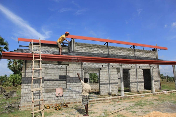
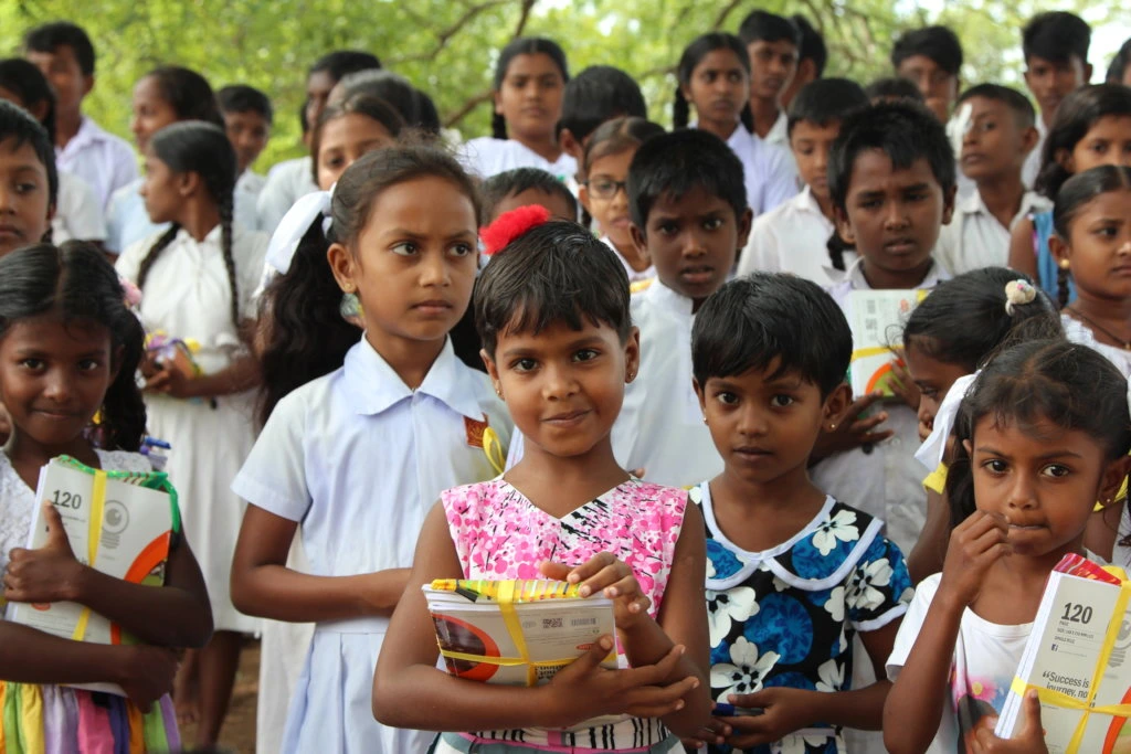
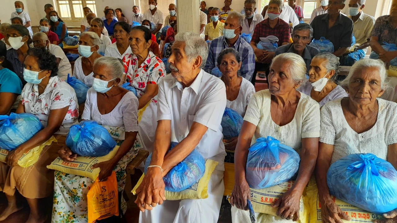
We care about our people. That’s why we offer Heartfelt Expedition
What is it?
Google Ranked #1, the Heartfelt Expedition is a unique tour that invites tourists to personally engage in charitable events from the perspective of a local donor. Participants will be involved in school initiatives, elderly adoption, and community assistance throughout Sri Lanka.
Discover authentic culture and make a difference by helping local communities.


